
[TopoExport.com] Frankfurt am Main.obj + Frankfurt am Main.dxf
Obliczymy ostateczną cenę na podstawie wybranego pliku. Sprawdzisz ją i zaakceptujesz przed płatnością.
Zapisane na tym urządzeniu.
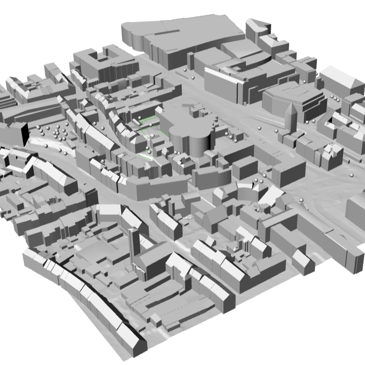
Frankfurt am Main, one of the major cities in Hesse, Germany!
- Ocena
- 0 / 5
- Polubienia
- 4
- Pobrania
- 30
- Wydruki
- 0
- Wyświetlenia
- 288
- Oceny
- 0
Aktualizacja u źródła:
Informacje o modelu
- Źródło
- Printables
- Kategoria
- Architecture & Urbanism
- Licencja
- Creative Commons — Attribution
Excited to share my latest 3D model of Frankfurt am Main, one of the major cities in Hesse, Germany! This model was generated using high-quality open data and extracted via TopoExport.com, a powerful tool for obtaining detailed city models in .OBJ, .STL, .DXF, and .IFC formats—perfect for 3D printing.
Frankfurt is not just a financial hub but also a key part of Hesse, with neighboring cities like Wiesbaden, Darmstadt, and Offenbach am Main. The model includes:
🔹 LoD2 buildings for a highly detailed cityscape
🌳 Tree coverage for an accurate representation of green spaces
🌍 High-precision topography based on 1m resolution terrain data
The data sources used for this model:
📌 HVBG ALKIS (2D buildings, parcels) – 2024
📌 HVBG 3D-Gebäudemodell LoD2 (LoD2 buildings) – 2022-2024
📌 HVBG DLM (roads, railways, hydrography, tree coverage) – 2024
📌 HVBG DGM1 (1m terrain model) – 2016-2023
Ich freue mich, mein neuestes 3D-Modell von Frankfurt am Main zu teilen, einer der wichtigsten Städte in Hessen! Dieses Modell wurde mit hochwertigen offenen Daten erstellt und über TopoExport.com extrahiert – ein leistungsstarkes Tool, um detaillierte Stadtmodelle in .OBJ, .STL, .DXF und .IFC-Formaten für den 3D-Druck zu erhalten.
Frankfurt ist nicht nur ein Finanzzentrum, sondern auch ein bedeutender Teil von Hessen, mit Nachbarstädten wie Wiesbaden, Darmstadt und Offenbach am Main. Das Modell enthält:
🔹 LoD2-Gebäude für eine detaillierte Stadtlandschaft
🌳 Baumabdeckung für eine realistische Darstellung der Grünflächen
🌍 Hochpräzise Topografie basierend auf Geländedaten mit 1m Auflösung
Die für dieses Modell verwendeten Datenquellen:
📌 HVBG ALKIS (2D-Gebäude, Grundstücke) – 2024
📌 HVBG 3D-Gebäudemodell LoD2 (LoD2-Gebäude) – 2022-2024
📌 HVBG DLM (Straßen, Eisenbahn, Hydrographie, Baumabdeckung) – 2024
📌 HVBG DGM1 (1m Geländemodell) – 2016-2023