
3D height map of Serra da Estrela (Portugal)
Obliczymy ostateczną cenę na podstawie wybranego pliku. Sprawdzisz ją i zaakceptujesz przed płatnością.
Zapisane na tym urządzeniu.

3D height map of Serra da Estrela (Portugal)
- Ocena
- 0 / 5
- Polubienia
- 13
- Pobrania
- 68
- Wydruki
- 0
- Wyświetlenia
- 618
- Oceny
- 0
Aktualizacja u źródła:
Informacje o modelu
- Źródło
- Printables
- Kategoria
- Architecture & Urbanism
- Licencja
- Creative Commons — Attribution — Noncommercial
This Model includes only the white part (actual 3D map). The green base is not included.
How I Designed This
I used this awesome website (https://contourmapcreator.urgr8.ch/) to generate the elevation data for a given region and to export the data to a .svg file.
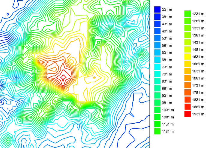
This .svg file can then be imported into Fusion 360 to serve as the basis for the creation of the 3D model.
The areas defined by the contour lines can be extruded up to any desired height. Basically, the highest elevation (1,930 m) will correspond to the total height from your model, and the other elevations can be scaled down accordingly.
Rendered design in Blender:
